
Mapping the lantern slides
Learn about the work undertaken by our 2020-21 MERL Open Spaces Society Fellow, Dr Katrina Navickas
Dr Katrina Navickas is the 2020/21 Open Spaces Society Fellow at The MERL. In this blog, Katrina outlines her work and research in mapping the locations of over 1,000 lantern slides in the Open Spaces Society collection.
The Open Spaces Society was founded in 1865 to campaign for and preserve commons, footpaths and open spaces that were being threatened with enclosure and urban development. The Open Spaces Society collection, which is kept at The MERL, contains (among other papers) around a thousand lantern slides depicting English landscapes from around 1900 to 1939.
What are lantern slides?
Lantern slides would be projected through a piece of technology known as a magic lantern. This was an early type of portable projector that remained in common use until the 1950s.
The lantern slides in the OSS Collection date to a time when the society was called the Commons and Footpaths Preservation Society. The images were likely to have been used to illustrate talks to promote the society’s campaigns and publicise its successes in saving public access to open spaces and rights of way. But there is very little other information about the slides other than brief titles. So one aim of my research is to locate the sites of all the slides and compare the landscapes with their locations today.
What’s in the boxes?
The majority of the lantern slides show landscapes in the south-east of England. The Open Spaces Society focused its early legal battles in the Home Counties, starting with campaigns to save Wimbledon Common in Surrey and Hampstead Heath in north London in the 1860s, and the formation of the National Trust by several of its influential members in 1895. The biggest proportion of slides (30% of all the collection) depict Surrey, especially Box Hill and the Surrey Hills, and the City of London commons that were purchased or managed as part of the Green Belt from the 1930s. Around 14% of the collection are of urban commons and parks, and about 13% show rivers and waterways.
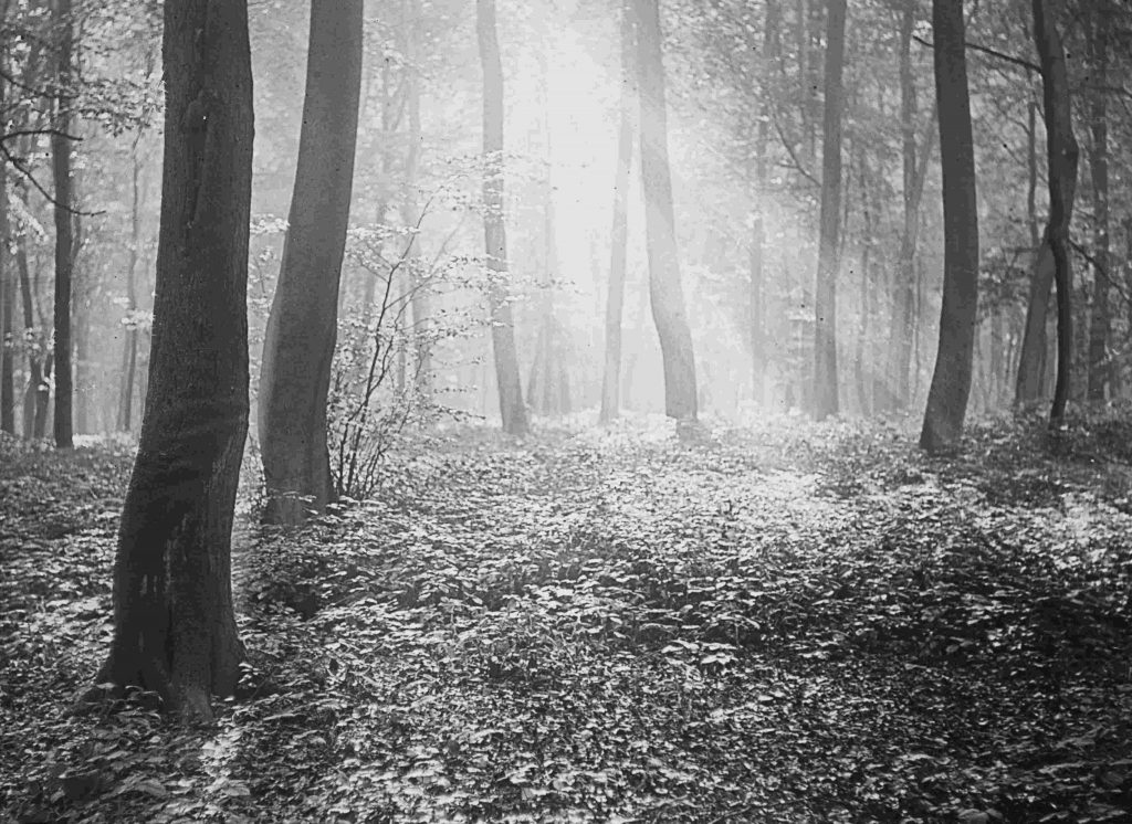
Ancient forests also feature heavily. There is a whole box of slides of Burnham Beeches forest in Buckinghamshire, acquired by the City of London in 1879, and another box including the New Forest in Hampshire, Epping Forest in Essex, and Ashdown Forest in Sussex. Another box follows the long-distance route of the Pilgrim’s Way from Winchester in Hampshire to Canterbury in Kent.
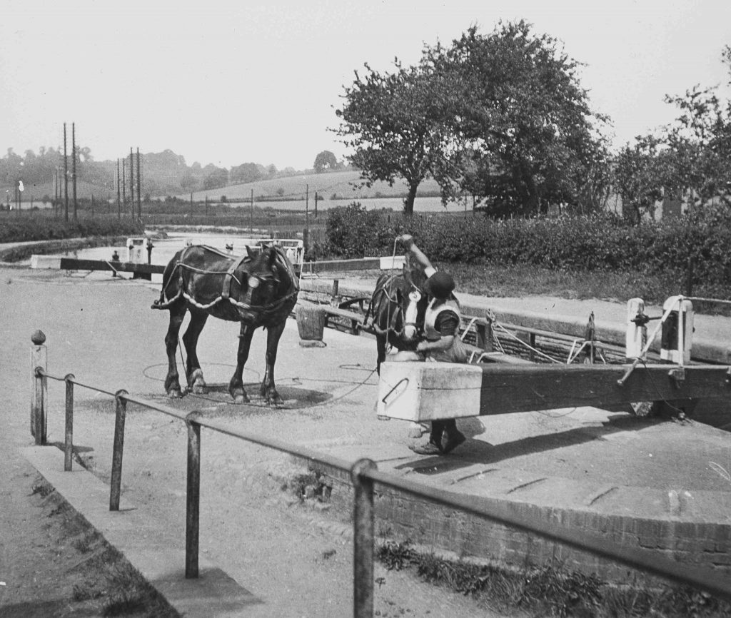
The River Thames is the subject of the next box, with scenes of towpaths and rope ferries along the route from Oxfordshire to Westminster. There is a box of images of metropolitan parks and commons, some of which had just been preserved against building and enclosure. One image, for example, titled ‘Cannon Hill Common 1928’ was taken just after the common was acquired by Merton and Morden Urban District Councils in 1927.
One box shows examples of stiles, fences, signposts, and some examples of the activities of the Commons and Footpaths Preservation Society in removing obstructions to rights of way. There are images of random historical images from paintings to medieval stone carvings. The penultimate box shows examples of types of landscape representative of counties in England and some Welsh, but not every county is included.
The final box is a collection of stock types of landscape, village scenes and natural flora and fauna. The village scenes include people looking somewhat posed (possibly staged?) in the picturesque village of Castle Combe, Wiltshire. There are several taken of the ruined St Mary’s Abbey, East Malling, Kent. Finally, there are portraits of the leading figures in the Commons and Footpaths Preservation Society and the National Trust, including Octavia Hill and Sir Robert Hunter.
What’s not in the boxes?
There are few images of places that would later become part of National Parks in 1949, such as the Lake District or the Peak District. The Open Spaces Society focused its early activities on southern England, so there are very few images of Wales and none of Scotland or Northern Ireland. There are very few people depicted in the images as a whole. Perhaps surprisingly, there are comparatively few images of footpaths, apart from some select images of obstructions that the Society had successfully cleared.
Locating in lockdown
The first aim of the project was to find the locations shown in the slides. This was no easy task, as many titles of the images are often no more specific than ‘large rocks on hill’ (yes, really) or ‘bridge and pub’.
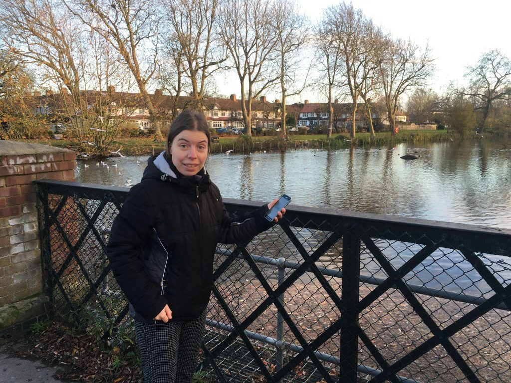
The nationwide travel restrictions in the winter of 2020-21 meant that I was confined to my local area to spot the locations of the slides. Luckily, I live in Croydon, south London, and I had been taking my lockdown walks in the open spaces and City of London commons in the Surrey suburban locations that feature heavily in the image collection. These included Riddlesdown Common and Banstead Woods, and the route of the river Wandle, now restored by the Wandle Trust.
Thanks to help from some keen location spotters on social media, and from contacts at the City of London conservators at Burnham Beeches and at the Railway and Canal Historical Society, I’ve been able to identify most of the locations, apart from the last couple of dozen images in the ‘landscape types’ box. There are some errors among the titles. The image titled ‘Tring lock, canal, Hertfordshire’, was identified by Fabian Hiscock, from the Railway and Canal Historical Society, as most likely located not at Tring, but lock 49 of the Grand Union Canal at Northchurch, near Berkhamsted, Hertfordshire.
To find the footpaths and viewpoints, I’ve been reliant on the extensive historic Ordnance Survey map collection online of the National Library of Scotland. Another really useful source for double-checking locations has been the image collection on Geograph.org, on which volunteers upload photographs of places in every OS grid square.
One of my local parks, Waddon Ponds, features in the image collection, together with the locations of now demolished and urbanised Waddon Mill and Waddon Court House. This is actually one of the few landscapes in the collection that has changed significantly with new housing estates and industrial buildings. Most of the other images are fairly unchanged, testimony to the work of the Open Spaces Society and the National Trust in preserving them for public access in perpetuity.
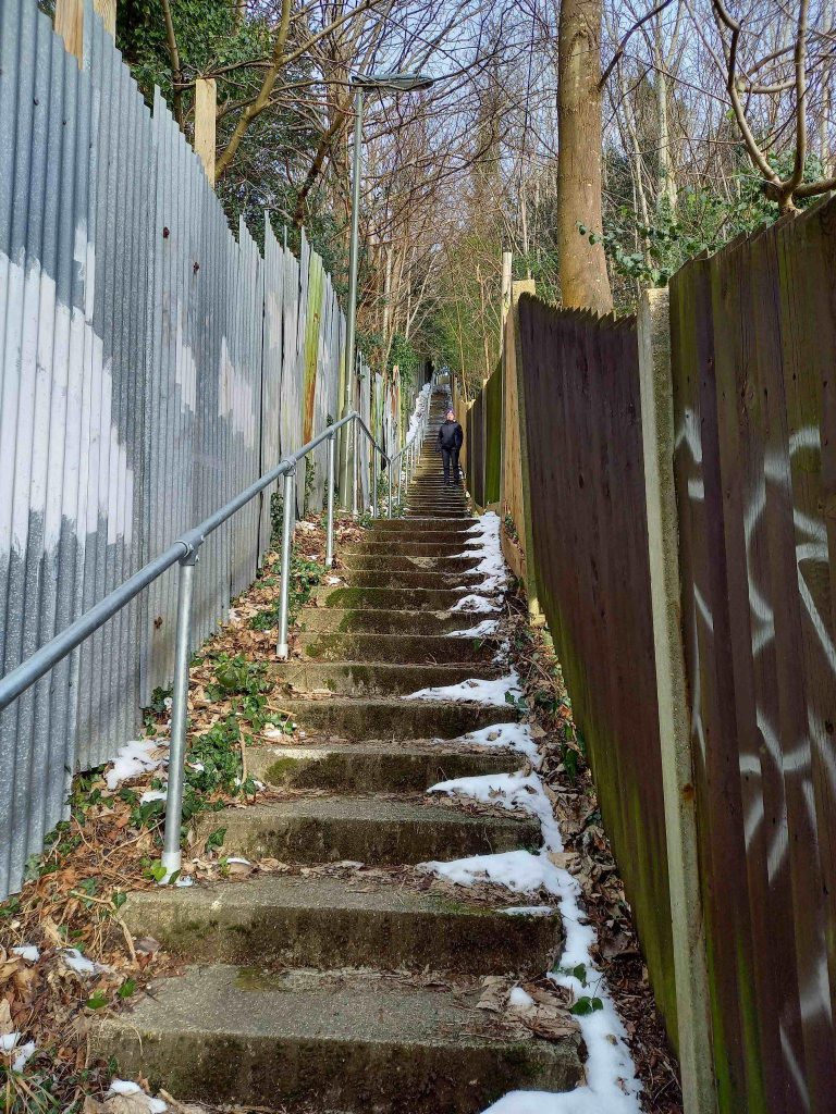
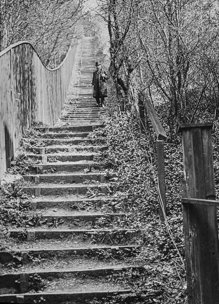
Here I am on a very cold day on ‘Jacobs Ladder steps’, a public right of way in Whyteleafe, in the same spot as the Edwardian gent in the lantern slide. The high corrugated metal fence on the left hand side is the boundary of the White House Club, a naturist reserve founded in 1933.
Future activities
The most striking lantern slides will be showcased in an online exhibition on The MERL website. I am currently undertaking more detailed research about some of the legal cases and sites that the Open Spaces Society were involved with. I will also be hosting an online symposium with The MERL and the OSS about the collection on the afternoon of 8 September. The symposium is open to everyone interested in exploring the images and sharing research on the history and future of open spaces.
Our thanks to Katrina for writing this introduction to her brilliant research. Find out more about Katrina’s MERL Fellowship, learn about historic MERL fellowships, or read more about the Open Spaces Society and their collection.