
A Land Down Under
Anthropologist and Collections Volunteer Paul Trawick continues his journey of subsoil discovery, exploring the role of land drainage on English farms. In his first post – What Lies Beneath? – he introduced us to these little-known systems. In this installment he elaborates further on their history and how they work…
We have already seen how British farmers developed a special way of saving soil from waterlogging and flood damage.
This ingenious underground solution was widely adopted during the mid-nineteenth century. Although most of us are blissfully unaware, at least half of the 11,000,000 acres of land farmed today in England and Wales is equipped with these invisible networks. The first such drains appeared several centuries earlier in France and were devised as a means to reclaim boggy land. Somehow this technology was forgotten in mainland Europe but British farmers adopted it, kept it alive, and developed it to its full potential.
It is thought that the earliest English example of their installation came in 1810, on Sir James Graham’s Northumberland estate. Their use expanded rapidly in the mid-nineteenth century, supported by well-financed government loans. It then spread back to mainland Europe and onward to rainier parts of the world. These underground systems are today referred to as ‘piped’ or ‘tiled’ drains. But how do they work?
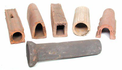
The MERL holds a large collection of different land drainage tiles from throughout the UK. Farmers link these segments of ceramic pipe to form extensive underground networks. These links are purposefully loose, allowing excess water to be siphoned out of heavily-saturated soils. A combination of suction and gravity encourages excess liquid to enter tiled drains from the sides and above, much as water flows out of a sink or bath. It leaches through those unsealed joints and, once inside, is piped rapidly downslope and away from cultivated land. From there it is discharged into large surface ditches that flank the lower edges of each field. Eventually it reaches other networks such as streams or rivers.
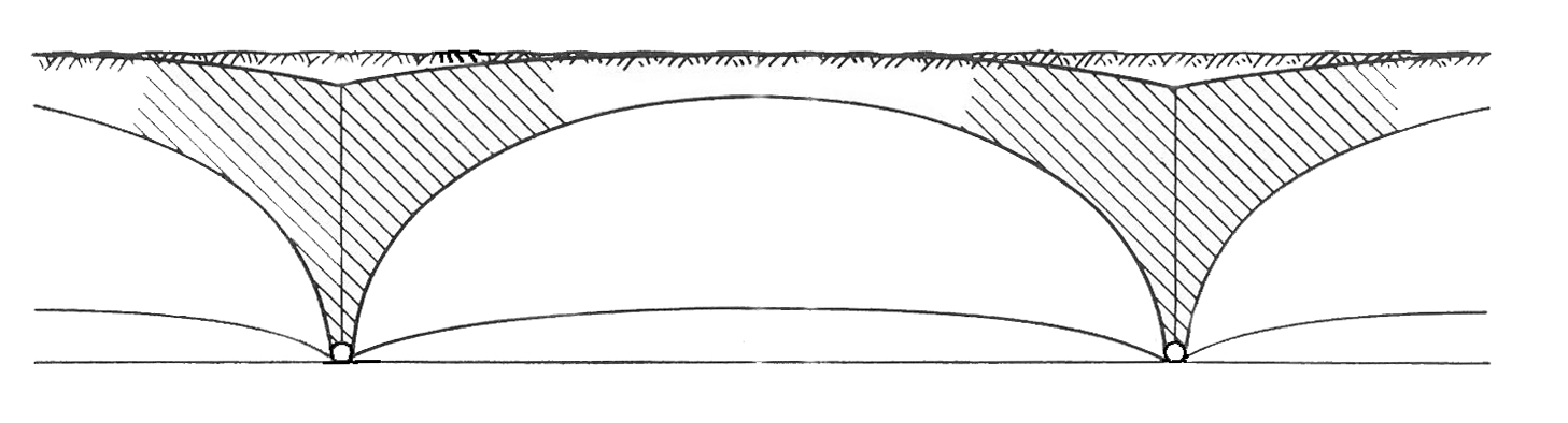
After heavy rainfall, the groundwater ‘table’ (the level of saturation) can rise to become visible on the surface, risking damage crops. The point of all this, usually at the farmers’ expense, is to lower this water table and protect livelihoods. Through their gradual but continual action, tiled drains not only get rid of excess but also help hold the watertable in place. To put this another way, these drains ensure that water stays where farmers need it, under the surface but at a safe remove from crop roots and stalks, where it can do no harm.
Different subterranean or surface-based solutions to these challenges are also found on many UK farms. These include the installation of shallow open ditches running across slopes to aid flood prevention. However, in many instances tiled drains have proven more effective than other solutions, hence their enduring popularity. The tiles in The MERL collection come in many shapes and sizes, revealing diverse regional variations.
Although generally made of baked clay, historically these tiles were crafted from various materials including stone, wood. Nowadays they are mostly plastic. The tiles at The MERL vary in diameter from as little as 7 cm to as many as 30. This is because they were used in networks comprising numerous lateral drainage lines (built with smaller tiles), which fed into larger channels (built with larger tiles).
These invisible networks are always bespoke because their placement depends on surface topography. They are laid out roughly perpendicular to surface contours, running downslope in parallel with the natural flow of groundwater. The watertable is full of so-called ‘hydrostatic’ water which stays put. However, this always has within it a slow and continual downward flow produced by gravity. Quite ingeniously, tiled drains are installed at the ideal level to manipulate the watertable in a beneficial way, anywhere from 90 cm to 1.5 metres below the surface.
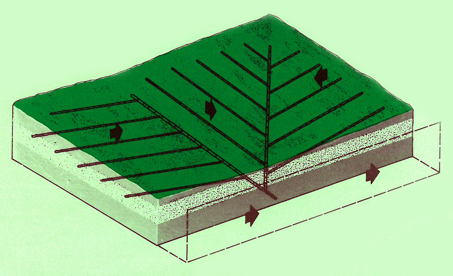
The pipes must be installed far enough beneath the surface (at least 90 cm) to keep the watertable well away from the deepest crop roots, which it would otherwise damage. According to government guidelines, lateral drains can be up to 300 metres long, and must be installed across a field at carefully-spaced intervals. The spacing between lateral branches depends on how porous or water-retaining a given soil is. Spaces are wide for porous ground (20 to 30 metres between) and narrower for less-permeable clays (about 10 metres between). In general, all tiled drains, whether laterals or main conduits, have only a very slight downward slope, one that must be constant over their entire length.
Soil scientists and hydrologists who have experimented with this technology suggest that 5cm of drop per 30 metres of pipe is the ideal for lateral drains, and only 2.5cm of drop per 30 horizontal metres is optimal for mains. This slight gradient must be constant to avoid flat spots that would cause water to slow, sit still, or to deposit silt and cause blockages.
Amazingly enough, if carefully-designed and installed in the recommended way, tiled drains require almost no maintenance. Such systems can continue to function very well over a period of centuries. In fact, their performance and efficiency have even been shown to improve with time. Imagine what a burden it was to install these systems. The vast scales of land managed by tiled drains reveal the extraordinary dedication and ingenuity of British farmers, past and present, and help us to see and celebrate their commitment to sustaining domestic food production.
In the next installment, we will look in more detail at the many benefits that the drains provide, turning our attention downstream, along larger surface ditches, streams, and rivers, to nearby villages and hamlets, to see where and how rural flood emergencies have developed and appeared most impactful in recent years.